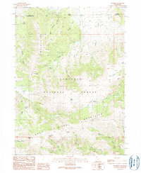
1990 Map of Standrod
USGS Topo · Published 1990About this map
Standrod sits at the northern edge of this high-elevation terrain, where the state line divides the land between Idaho and Utah. The landscape is dominated by the Sawtooth Mountains and the Raft River Mountains, with the Sawtooth National Forest covering much of the central topography. This area shows clear evidence of resource extraction and land management, from an Open Pit Mine and various Prospect Adits to the Gaging Station located along the drainages. Numerous springs, such as Dipping Vat Spring and Onemile FS Station Spring, provided vital water sources for early forestry and ranching operations. The varied terrain includes the South Little Fork Valley and prominent summits like George & George Peak, illustrating the complex drainage patterns of Fisher Creek and George Creek that carve through the local canyons.
Find a feature on this map
44 named features on this map. Tap any name to fly to it.
Don’t see what you’re looking for? This feature index may not catch every label — zoom into the map to look around manually.
Map Details
Editions of this 1990 Standrod Map
This is the sole edition of this map. No revisions or reprints were ever made.
Other maps of this area

1954 · Pocatello
USGS Topo · 1:250,000

1954 · Brigham City
USGS Topo · 1:250,000

1958 · Pocatello
USGS Topo · 1:250,000

1958 · Brigham City
USGS Topo · 1:250,000

1959 · Park Valley
USGS Topo · 1:62,500

1959 · Yost
USGS Topo · 1:62,500

1962 · Brigham City
USGS Topo · 1:250,000

1968 · Jim Sage Canyon
USGS Topo · 1:24,000

1968 · Naf
USGS Topo · 1:24,000

1968 · Chokecherry Canyon
USGS Topo · 1:24,000