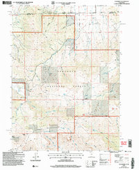
2001 Map of Standrod
USGS Topo · Published 2006About this map
Standrod serves as a lone outpost on the Idaho-Utah state line, situated where the high-altitude terrain of the Sawtooth National Forest meets the northern reaches of the Raft River Mountains. This 2001 revision highlights a landscape of extraction and high-country hydrology, with several Prospect Adits and Open Pit Mines scattered near Barnette Hollow and Limekiln Hollow.
Find a feature on this map
50 named features on this map. Tap any name to fly to it.
Don’t see what you’re looking for? This feature index may not catch every label — zoom into the map to look around manually.
Map Details
Editions of this 2001 Standrod Map
This is the sole edition of this map. No revisions or reprints were ever made.
Other maps of this area

1954 · Pocatello
USGS Topo · 1:250,000

1954 · Brigham City
USGS Topo · 1:250,000

1958 · Pocatello
USGS Topo · 1:250,000

1958 · Brigham City
USGS Topo · 1:250,000

1959 · Park Valley
USGS Topo · 1:62,500

1959 · Yost
USGS Topo · 1:62,500

1962 · Brigham City
USGS Topo · 1:250,000

1968 · Jim Sage Canyon
USGS Topo · 1:24,000

1968 · Naf
USGS Topo · 1:24,000

1968 · Chokecherry Canyon
USGS Topo · 1:24,000