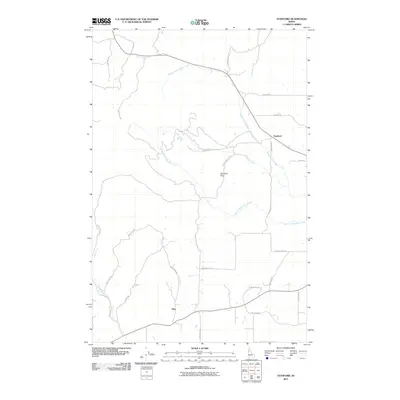
2011 Map of Stanford
USGS Topo · Published 2011About this map
Stanford and Nora serve as the primary settlement points in this pocket of Latah County, where the landscape is defined by the complex drainage network of the Big Bear Creek system. The terrain transitions from the upland heights of Stanford Point down into valleys carved by the Middle Fork Big Bear Creek and the West Fork Big Bear Creek. This 2011 survey illustrates a rural infrastructure centered on agriculture and timber, with a grid of named roads like Pleasant Hill Rd and White Pine Flats Rd providing access to the more remote ridges and creek bottoms. The presence of features like Clay Pit Rd suggests local extraction industries, while the numerous small tributaries, including Spring Valley Creek, Bergs Creek, and Nora Creek, underscore the hydrological importance of this region to the larger Clearwater River watershed.
Find a feature on this map
29 named features on this map. Tap any name to fly to it.
Don’t see what you’re looking for? This feature index may not catch every label — zoom into the map to look around manually.
Map Details
Editions of this 2011 Stanford Map
This is the sole edition of this map. No revisions or reprints were ever made.
Other maps of this area

1955 · Pullman
USGS Topo · 1:250,000

1958 · Pullman
USGS Topo · 1:250,000

1960 · Troy
USGS Topo · 1:24,000

1960 · Moscow Mtn
USGS Topo · 1:24,000

1960 · Potlatch
USGS Topo · 1:62,500

1961 · Deary
USGS Topo · 1:62,500

1961 · Kendrick
USGS Topo · 1:62,500

1961 · Moscow
USGS Topo · 1:62,500

1981 · Potlatch
USGS Topo · 1:100,000
1990 · Stanford
USGS Topo · 1:24,000