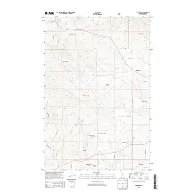
2014 Map of Stanford
USGS Topo · Published 2014About this map
The Palouse Range defines the northwest corner of this landscape, where the terrain transitions into a complex system of ridges and drainages. The small settlement of Stanford sits at a road junction in the northeast, while Nora serves as a secondary focal point to the south. This area of Latah County is characterized by its agricultural and rural infrastructure, most notably the Friendly Persuasion Farm Airport located central to the map.
Find a feature on this map
44 named features on this map. Tap any name to fly to it.
Don’t see what you’re looking for? This feature index may not catch every label — zoom into the map to look around manually.
Map Details
Editions of this 2014 Stanford Map
This is the sole edition of this map. No revisions or reprints were ever made.
Other maps of this area

1955 · Pullman
USGS Topo · 1:250,000

1958 · Pullman
USGS Topo · 1:250,000

1960 · Troy
USGS Topo · 1:24,000

1960 · Moscow Mtn
USGS Topo · 1:24,000

1960 · Potlatch
USGS Topo · 1:62,500

1961 · Deary
USGS Topo · 1:62,500

1961 · Kendrick
USGS Topo · 1:62,500

1961 · Moscow
USGS Topo · 1:62,500

1981 · Potlatch
USGS Topo · 1:100,000
1990 · Stanford
USGS Topo · 1:24,000