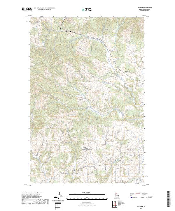
2024 Map of Stanford
USGS Topo · Published 2024About this map
Stanford sits at the eastern edge of this Latah County landscape, where the northern slopes of the Palouse Range give way to a complex network of creek drainages. The area is defined by its agricultural and upland character, marked by prominent elevations such as Stanford Point and the long southern stretch of Little Bear Ridge. A dense web of rural roads, including White Pine Flats Rd and Pleasant Hill Rd, connects the scattered farmsteads across the township lines.
Find a feature on this map
42 named features on this map. Tap any name to fly to it.
Don’t see what you’re looking for? This feature index may not catch every label — zoom into the map to look around manually.
Map Details
Editions of this 2024 Stanford Map
This is the sole edition of this map. No revisions or reprints were ever made.
Other maps of this area

1955 · Pullman
USGS Topo · 1:250,000

1958 · Pullman
USGS Topo · 1:250,000

1960 · Troy
USGS Topo · 1:24,000

1960 · Moscow Mtn
USGS Topo · 1:24,000

1960 · Potlatch
USGS Topo · 1:62,500

1961 · Deary
USGS Topo · 1:62,500

1961 · Kendrick
USGS Topo · 1:62,500

1961 · Moscow
USGS Topo · 1:62,500

1981 · Potlatch
USGS Topo · 1:100,000
1990 · Stanford
USGS Topo · 1:24,000