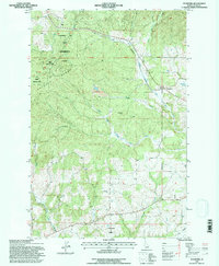
1994 Map of Stanford
USGS Topo · Published 1997About this map
The Palouse Range defines the northern reaches of this Idaho landscape, where the University of Idaho Experimental Forest occupies a significant portion of the timbered uplands. This area, updated in the mid-1990s from older 1950s aerial photography, reveals a transition from managed forest to the agricultural and industrial activity surrounding the settlement of Stanford. The local economy is visibly tied to the land, with several extractive sites such as an Open Pit Mine, Gravel Pit, Quarry, and Clay Pit scattered throughout the drainage basins.
Find a feature on this map
26 named features on this map. Tap any name to fly to it.
Don’t see what you’re looking for? This feature index may not catch every label — zoom into the map to look around manually.
Map Details
Editions of this 1994 Stanford Map
This is the sole edition of this map. No revisions or reprints were ever made.
Other maps of this area

1955 · Pullman
USGS Topo · 1:250,000

1958 · Pullman
USGS Topo · 1:250,000

1960 · Troy
USGS Topo · 1:24,000

1960 · Moscow Mtn
USGS Topo · 1:24,000

1960 · Potlatch
USGS Topo · 1:62,500

1961 · Deary
USGS Topo · 1:62,500

1961 · Kendrick
USGS Topo · 1:62,500

1961 · Moscow
USGS Topo · 1:62,500

1981 · Potlatch
USGS Topo · 1:100,000
1990 · Stanford
USGS Topo · 1:24,000