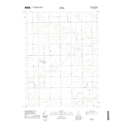
2021 Map of Stanford
USGS Topo · Published 2021About this map
Stanford sits at the heart of this McLean County landscape, defined by a grid of rural roads that intersect the flowing courses of Middle Fork Sugar Cr and W Fork Sugar Cr. The village is structured around W Main St and N Division St, serving as a central hub for the surrounding agricultural tracts. For those researching local heritage, the map identifies significant burial sites such as Mount Pleasant Cem to the north and Brooks Grove Cem to the south. The drainage patterns of Kings Mill Cr and Sugar Creek carve through the terrain, illustrating the natural water network that has historically dictated the placement of homesteads and farmsteads in this part of Illinois.
Find a feature on this map
49 named features on this map. Tap any name to fly to it.
Don’t see what you’re looking for? This feature index may not catch every label — zoom into the map to look around manually.
Map Details
Editions of this 2021 Stanford Map
This is the sole edition of this map. No revisions or reprints were ever made.
Other maps of this area

1927 · Danvers
USGS Topo · 1:62,500

1928 · Mackinaw
USGS Topo · 1:62,500

1930 · Danvers
USGS Topo · 1:62,500

1932 · Mackinaw
USGS Topo · 1:62,500

1949 · Mc Lean
USGS Topo · 1:62,500

1951 · McLean
USGS Topo · 1:62,500

1951 · Minier
USGS Topo · 1:62,500

1958 · Peoria
USGS Topo · 1:250,000

1961 · Peoria
USGS Topo · 1:250,000

1963 · Peoria
USGS Topo · 1:250,000