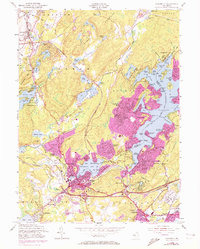
1954 Map of Stanhope
USGS Topo · Published 1972About this map
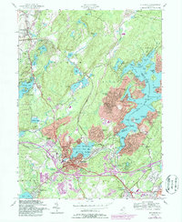
Lake Musconetcong and the complex shoreline of Lake Hopatcong serve as the anchors for this mid-century look at the Sussex and Morris County border. The terrain is defined by the Sparta Mountains and Allamuchy Mtn, where numerous small water bodies like Stag Pond and Panther Lake sit among the ridges. This era shows the suburban expansion of Hopatcong and Mount Arlington indicated in purple, contrasting with the more established grid of Stanhope and Netcong. Transport remains central to the landscape, with the Central RR of New Jersey and Erie Lackawanna corridors tracing the valley near the Musconetcong River. Local landmarks range from the Lake Lackawanna Golf Course to the Stanhope Union Cem, while industrial activity is noted at the Gravel Pit near the Bear Pond area.
Find a feature on this map
121 named features on this map. Tap any name to fly to it.
Don’t see what you’re looking for? This feature index may not catch every label — zoom into the map to look around manually.
Map Details
Editions of this 1954 Stanhope Map
5 editions found
Other maps of this area

1888 · Franklin
USGS Topo · 1:62,500

1888 · Hackettstown
USGS Topo · 1:62,500

1888 · Lake Hopatcong
USGS Topo · 1:62,500

1891 · Wallpack
USGS Topo · 1:62,500

1893 · Wallpack
USGS Topo · 1:62,500

1894 · Hackettstown
USGS Topo · 1:62,500

1894 · Lake Hopatcong
USGS Topo · 1:62,500

1894 · Franklin
USGS Topo · 1:62,500

1897 · Franklin
USGS Topo · 1:62,500

1898 · Lake Hopatcong
USGS Topo · 1:62,500