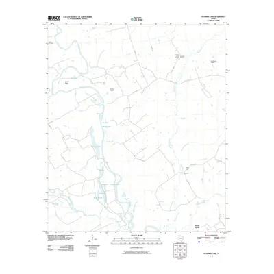
2010 Map of Stanmire Lake
USGS Topo · Published 2010About this map
The Trinity River creates a winding western boundary for this landscape, carving deep loops like Mitchell Bend as it flows south through Houston County. Along its course, a complex network of oxbow lakes and bottomlands includes Stanmire Lake, Middle Lake, and Alligator Lake, illustrating the river's historical shifts. The area transitions from these low-lying wetlands to the upland energy production of the Navarro Crossing Oil Field.
Find a feature on this map
37 named features on this map. Tap any name to fly to it.
Don’t see what you’re looking for? This feature index may not catch every label — zoom into the map to look around manually.
Map Details
Editions of this 2010 Stanmire Lake Map
This is the sole edition of this map. No revisions or reprints were ever made.
Other maps of this area

1951 · Elkhart
USGS Topo · 1:62,500

1953 · Palestine
USGS Topo · 1:250,000

1957 · Palestine
USGS Topo · 1:250,000

1964 · Oakwood
USGS Topo · 1:24,000

1964 · Porter Springs
USGS Topo · 1:24,000

1964 · Eunice
USGS Topo · 1:24,000

1964 · Halls Bluff
USGS Topo · 1:24,000

1964 · Lake Leon
USGS Topo · 1:24,000

1964 · Hays Spring
USGS Topo · 1:24,000

1964 · Stanmire Lake
USGS Topo · 1:24,000