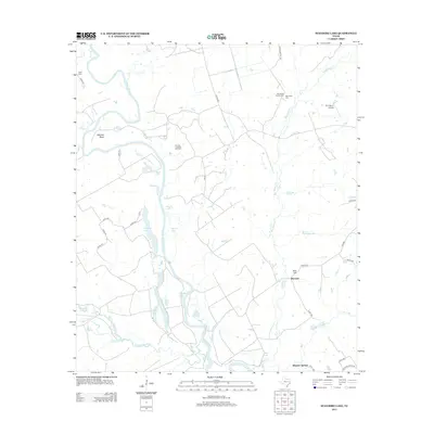
2013 Map of Stanmire Lake
USGS Topo · Published 2013About this map
The Trinity River snakes through this East Texas landscape, defining a complex system of oxbows and flood-plain lakes including Stanmire Lake, Field Lake, and Alligator Lake. Along the river’s western edge, the Mitchell Bend and Bluff terrain overlook the water, while the Navarro Crossing Oil Field indicates the region’s industrial history. This 2013 survey provides a detailed record of local family history through several burial grounds, including the Old Dalley Family Cem, Wes Hicks Cem, and Bluff Cem. Settlements like Reynard and Wheeler Springs anchor the road network, which is composed of state routes such as FM 227 and various county roads. The eastern portion of the map is drained by Big Elkhart Cr and its tributaries like Meriwether Br, flowing through a geography marked by significant local landmarks such as Kent Hill.
Find a feature on this map
49 named features on this map. Tap any name to fly to it.
Don’t see what you’re looking for? This feature index may not catch every label — zoom into the map to look around manually.
Map Details
Editions of this 2013 Stanmire Lake Map
This is the sole edition of this map. No revisions or reprints were ever made.
Other maps of this area

1951 · Elkhart
USGS Topo · 1:62,500

1953 · Palestine
USGS Topo · 1:250,000

1957 · Palestine
USGS Topo · 1:250,000

1964 · Oakwood
USGS Topo · 1:24,000

1964 · Porter Springs
USGS Topo · 1:24,000

1964 · Eunice
USGS Topo · 1:24,000

1964 · Halls Bluff
USGS Topo · 1:24,000

1964 · Lake Leon
USGS Topo · 1:24,000

1964 · Hays Spring
USGS Topo · 1:24,000

1964 · Stanmire Lake
USGS Topo · 1:24,000