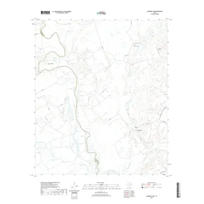
2019 Map of Stanmire Lake
USGS Topo · Published 2019About this map
The Trinity River snakes through the bottomlands of the Houston and Leon county line, carving a complex landscape of oxbow lakes and alluvial bends. The river's historical shifts are evidenced by a series of named backwaters including Alligator Lake, Buzzard Lake, and Zeke Lake, which dominate the western side of the survey. On the higher ground east of the river, the small settlement of Reynard sits near Kent Hill, marking one of the few concentrated areas of development in this largely riparian environment.
Find a feature on this map
50 named features on this map. Tap any name to fly to it.
Don’t see what you’re looking for? This feature index may not catch every label — zoom into the map to look around manually.
Map Details
Editions of this 2019 Stanmire Lake Map
This is the sole edition of this map. No revisions or reprints were ever made.
Other maps of this area

1951 · Elkhart
USGS Topo · 1:62,500

1953 · Palestine
USGS Topo · 1:250,000

1957 · Palestine
USGS Topo · 1:250,000

1964 · Oakwood
USGS Topo · 1:24,000

1964 · Porter Springs
USGS Topo · 1:24,000

1964 · Eunice
USGS Topo · 1:24,000

1964 · Halls Bluff
USGS Topo · 1:24,000

1964 · Lake Leon
USGS Topo · 1:24,000

1964 · Hays Spring
USGS Topo · 1:24,000

1964 · Stanmire Lake
USGS Topo · 1:24,000