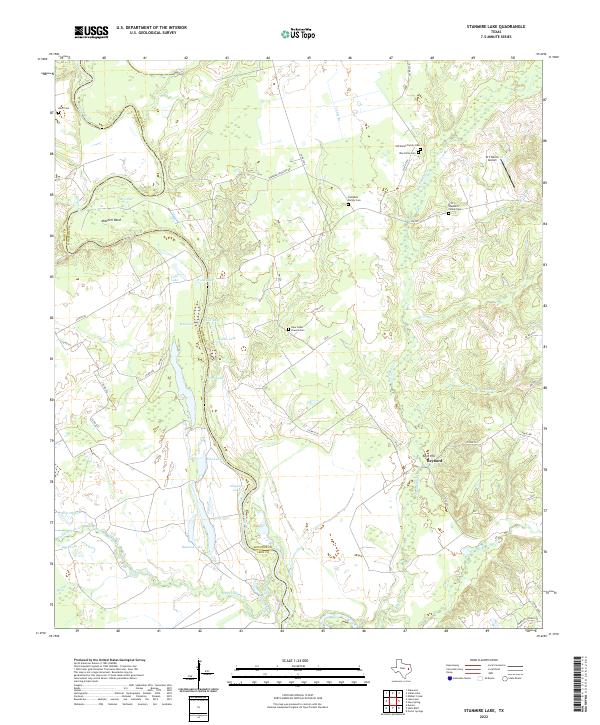
2022 Map of Stanmire Lake
USGS Topo · Published 2022About this map
Mitchell Bend and the winding course of the Trinity River define the boundary between Leon and Houston counties in this pocket of East Texas. The landscape is a complex of oxbow lakes and wetlands, including Stanmire Lake, Alligator Lake, Buzzard Lake, and Field Lake, illustrating the river's historical shifts across the bottomlands. These water bodies, along with Keechi Cr and Big Elkhart Cr, dictate the movement of roads like Navarro Crossing RD and FM 227, which must navigate the low-lying terrain to connect rural settlements like Reynard.
Find a feature on this map
55 named features on this map. Tap any name to fly to it.
Don’t see what you’re looking for? This feature index may not catch every label — zoom into the map to look around manually.
Map Details
Editions of this 2022 Stanmire Lake Map
This is the sole edition of this map. No revisions or reprints were ever made.
Other maps of this area

1951 · Elkhart
USGS Topo · 1:62,500

1953 · Palestine
USGS Topo · 1:250,000

1957 · Palestine
USGS Topo · 1:250,000

1964 · Oakwood
USGS Topo · 1:24,000

1964 · Porter Springs
USGS Topo · 1:24,000

1964 · Eunice
USGS Topo · 1:24,000

1964 · Halls Bluff
USGS Topo · 1:24,000

1964 · Lake Leon
USGS Topo · 1:24,000

1964 · Hays Spring
USGS Topo · 1:24,000

1964 · Stanmire Lake
USGS Topo · 1:24,000