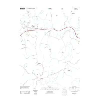
2013 Map of Stanton
USGS Topo · Published 2013About this map
Stanton serves as the hub of this Central Kentucky landscape, where the Red River winds eastward toward smaller settlements like Rosslyn and Bowen. The terrain transitions from the developed corridor around the Stanton Interchange to the dense ridges of the southeast, marked by landmarks such as the High Rock Lookout Tower and Hemlock Lodge. These features suggest a region shaped by both its river-bottom agriculture and a growing recreation and forestry economy.
Find a feature on this map
103 named features on this map. Tap any name to fly to it.
Don’t see what you’re looking for? This feature index may not catch every label — zoom into the map to look around manually.
Map Details
Editions of this 2013 Stanton Map
This is the sole edition of this map. No revisions or reprints were ever made.
Other maps of this area

1892 · Beattyville
USGS Topo · 1:125,000

1950 · Levee
USGS Topo · 1:24,000

1952 · Clay City
USGS Topo · 1:24,000

1952 · Frenchburg
USGS Topo · 1:24,000

1952 · Stanton
USGS Topo · 1:24,000

1952 · Means
USGS Topo · 1:24,000

1952 · Levee
USGS Topo · 1:24,000

1952 · Slade
USGS Topo · 1:24,000

1952 · Cobhill
USGS Topo · 1:24,000

1952 · Irvine
USGS Topo · 1:24,000