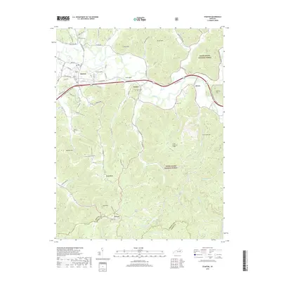
2019 Map of Stanton
USGS Topo · Published 2019About this map
Stanton serves as the primary hub of this eastern Kentucky landscape, situated north of the Bert T Combs Mountain Parkway and the winding Red River. The geography transitions from the developed corridors near Stanton Airport to the heavily forested ridges of the Daniel Boone National Forest. To the south, smaller settlements like Furnace and Knowlton are tucked into the valleys, while family-named landmarks such as McKinney Cliff and Congleton Mtn define the high ground. Local history is preserved in several rural burial sites, including Rest Haven Cem and Hatton Creek Cem. The network of creeks—such as Cat Cr and Hardwick Cr—illustrates the traditional settlement patterns where communities formed along narrow watercourses. This survey documents the intersection of modern infrastructure and the enduring rural character of the Powell and Estill County line.
Find a feature on this map
83 named features on this map. Tap any name to fly to it.
Don’t see what you’re looking for? This feature index may not catch every label — zoom into the map to look around manually.
Map Details
Editions of this 2019 Stanton Map
This is the sole edition of this map. No revisions or reprints were ever made.
Other maps of this area

1892 · Beattyville
USGS Topo · 1:125,000

1950 · Levee
USGS Topo · 1:24,000

1952 · Clay City
USGS Topo · 1:24,000

1952 · Frenchburg
USGS Topo · 1:24,000

1952 · Stanton
USGS Topo · 1:24,000

1952 · Means
USGS Topo · 1:24,000

1952 · Levee
USGS Topo · 1:24,000

1952 · Slade
USGS Topo · 1:24,000

1952 · Cobhill
USGS Topo · 1:24,000

1952 · Irvine
USGS Topo · 1:24,000