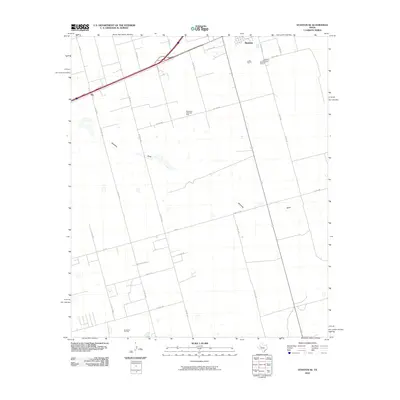
2010 Map of Stanton SE
USGS Topo · Published 2010About this map
The West Texas petroleum economy dominates this 2010 landscape, characterized by the expansive Spraberry Trend Oil Field and the Germania Oil Field in the south. The city of Stanton appears in the northern corner, where the Evergreen Cemetery and a network of county roads provide important reference points for local genealogy and history. The terrain is defined by the subtle topography of Mustang Draw, which winds across the plains alongside long-established transportation routes like FM 307 and Ranch Rd 307. The small settlement of Dix sits near the western edge along I-20 Bus, marking a quiet intersection of regional transit and industrial land use. This survey illustrates the rhythmic layout of rural section roads and the persistent importance of the oil and gas industry to the growth of this Martin County region.
Find a feature on this map
32 named features on this map. Tap any name to fly to it.
Don’t see what you’re looking for? This feature index may not catch every label — zoom into the map to look around manually.
Map Details
Editions of this 2010 Stanton SE Map
This is the sole edition of this map. No revisions or reprints were ever made.
Other maps of this area

1941 · Morita
USGS Topo · 1:62,500

1949 · Morita
USGS Topo · 1:62,500

1954 · Big Spring
USGS Topo · 1:250,000

1954 · San Angelo
USGS Topo · 1:250,000

1958 · San Angelo
USGS Topo · 1:250,000

1958 · Big Spring
USGS Topo · 1:250,000

1965 · San Angelo
USGS Topo · 1:250,000

1965 · Dewey Lake
USGS Topo · 1:24,000

1965 · Spraberry
USGS Topo · 1:24,000
1965 · Stephenson Lake
USGS Topo · 1:24,000