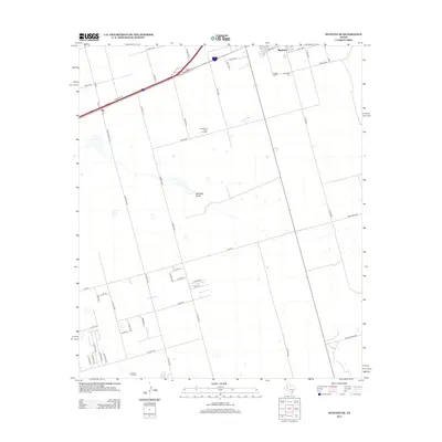
2012 Map of Stanton SE
USGS Topo · Published 2012About this map
Spraberry Trend Oil Field and the Germania Oil Field dominate the landscape of this Permian Basin survey, highlighting the intensive petroleum development south of Stanton. The map captures a high-desert environment defined by the ephemeral path of Mustang Draw, where the vast industrial footprint of wells and access roads contrasts with local landmarks like Evergreen Cem.
Find a feature on this map
50 named features on this map. Tap any name to fly to it.
Don’t see what you’re looking for? This feature index may not catch every label — zoom into the map to look around manually.
Map Details
Editions of this 2012 Stanton SE Map
This is the sole edition of this map. No revisions or reprints were ever made.
Other maps of this area

1941 · Morita
USGS Topo · 1:62,500

1949 · Morita
USGS Topo · 1:62,500

1954 · Big Spring
USGS Topo · 1:250,000

1954 · San Angelo
USGS Topo · 1:250,000

1958 · San Angelo
USGS Topo · 1:250,000

1958 · Big Spring
USGS Topo · 1:250,000

1965 · San Angelo
USGS Topo · 1:250,000

1965 · Dewey Lake
USGS Topo · 1:24,000

1965 · Spraberry
USGS Topo · 1:24,000
1965 · Stephenson Lake
USGS Topo · 1:24,000