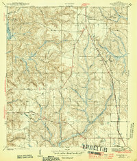
1944 Map of Stapleton
USGS Topo · Published 1944About this map
The Stapleton area of Baldwin County is defined by its strategic position along the Louisville and Nashville railroad and the historic Spanish Trail. Surveyed just before the United States entered World War II, this map documents the agricultural and communal foundations of the region, featuring a high density of small churches and family burial grounds like Durant Cem and Greenwood Cem.
Find a feature on this map
34 named features on this map. Tap any name to fly to it.
Don’t see what you’re looking for? This feature index may not catch every label — zoom into the map to look around manually.
Map Details
Editions of this 1944 Stapleton Map
2 editions found
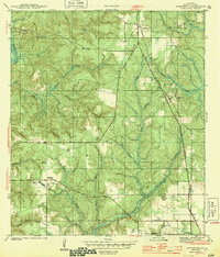
Other maps of this area

1920 · Robertsdale
USGS Topo · 1:62,500

1921 · Fairhope
USGS Topo · 1:62,500

1939 · Daphne
USGS Topo · 1:31,680

1940 · Silverhill
USGS Topo · 1:31,680

1941 · Daphne
USGS Topo · 1:31,680

1941 · Silverhill
USGS Topo · 1:31,680

1941 · Blakeley
USGS Topo · 1:31,680

1941 · Bay Minette
USGS Topo · 1:62,500

1941 · Robertsdale
USGS Topo · 1:62,500

1941 · Fairhope
USGS Topo · 1:62,500