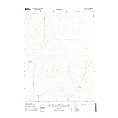
2014 Map of Stapleton SW
USGS Topo · Published 2014About this map
Sandhills Rd anchors the western portion of this Lincoln County landscape, winding through the distinctive dune topography that characterizes this part of Nebraska. The area is defined by a sparse but organized network of rural routes, primarily serving ranching and agricultural interests in the early twenty-first century. The primary north-south artery, Us-83, cuts diagonally across the southeastern corner of the quadrangle, connecting this rural interior with broader regional travel corridors. Secondary roads such as E Barrett Rd, E Stewart Rd, and Ehler Rd provide access to the interior sections, where the terrain remains largely dominated by the natural contours of the sandhills. The naming of local routes like Llama Rd and E Walkers View Rd suggests a landscape shaped by long-standing local property boundaries and individual land use histories.
Find a feature on this map
12 named features on this map. Tap any name to fly to it.
Don’t see what you’re looking for? This feature index may not catch every label — zoom into the map to look around manually.
Map Details
Editions of this 2014 Stapleton SW Map
This is the sole edition of this map. No revisions or reprints were ever made.
Other maps of this area

1899 · North Platte
USGS Topo · 1:125,000

1902 · North Platte
USGS Topo · 1:125,000

1954 · North Platte
USGS Topo · 1:250,000

1956 · North Platte
USGS Topo · 1:250,000

1957 · North Platte
USGS Topo · 1:250,000

1967 · North Platte
USGS Topo · 1:250,000

1970 · North Platte East
USGS Topo · 1:24,000

1970 · North Platte West
USGS Topo · 1:24,000
1970 · Maxwell NE
USGS Topo · 1:24,000

1972 · Stapleton NW
USGS Topo · 1:24,000