
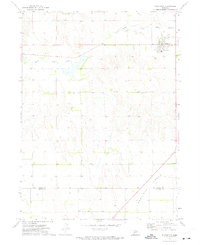
1972 Map of Stapleton NW
USGS Topo · Published 1975About this map
The South Loup River winds through the northern portion of this Nebraska landscape, providing a critical water source in a region defined by its wide-ranging cattle operations. Settled during an era of ranching expansion, the area is home to established sites like the Rundback Ranch and Fowler Ranch, which highlight the importance of family-owned livestock territories in Logan County. This 1972 survey captures the transition between McPherson, Logan, and Lincoln counties, where political boundaries meet the practical needs of the high plains. Genealogy and local history are anchored at the Loup Valley Cemetery, while several marked Well locations across the terrain illustrate the vital infrastructure required to support life and industry away from the river banks.
Find a feature on this map
8 named features on this map. Tap any name to fly to it.
Don’t see what you’re looking for? This feature index may not catch every label — zoom into the map to look around manually.
Map Details
Editions of this 1972 Stapleton NW Map
This is the sole edition of this map. No revisions or reprints were ever made.
Other maps of this area

1899 · North Platte
USGS Topo · 1:125,000

1902 · North Platte
USGS Topo · 1:125,000

1949 · Cody Lake
USGS Topo · 1:62,500

1951 · Tryon
USGS Topo · 1:62,500

1951 · Cody Lake
USGS Topo · 1:62,500

1954 · North Platte
USGS Topo · 1:250,000

1956 · North Platte
USGS Topo · 1:250,000

1957 · North Platte
USGS Topo · 1:250,000

1967 · North Platte
USGS Topo · 1:250,000
1972 · Stapleton
USGS Topo · 1:24,000