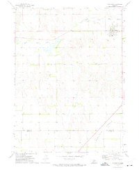
1972 Map of Stapleton
USGS Topo · Published 1975About this map
Stapleton serves as the primary hub of this Logan County landscape in the early 1970s, situated at the intersection of local industry and transit. The town's grid is defined by its relationship with the U P railroad line and its proximity to the South Loup River, which meanders across the northern portion of the map. This survey reveals the specialized agricultural and aviation infrastructure of the era, from the Wilcox Ranch to the Baskin Ranch Landing Strip. To the south, the terrain rises into the prominent Garfield Table, while the border of Logan Co Lincoln Co marks the southern extent of the quadrangle. Small-scale industrial markers like a Sandpit, Substation, and several isolated Well sites point to the resource management required for ranching in this central Nebraska region.
Find a feature on this map
11 named features on this map. Tap any name to fly to it.
Don’t see what you’re looking for? This feature index may not catch every label — zoom into the map to look around manually.
Map Details
Editions of this 1972 Stapleton Map
This is the sole edition of this map. No revisions or reprints were ever made.
Other maps of this area

1899 · North Platte
USGS Topo · 1:125,000

1902 · North Platte
USGS Topo · 1:125,000

1949 · Cody Lake
USGS Topo · 1:62,500

1951 · Cody Lake
USGS Topo · 1:62,500

1951 · Hoagland
USGS Topo · 1:62,500

1954 · North Platte
USGS Topo · 1:250,000

1956 · North Platte
USGS Topo · 1:250,000

1957 · North Platte
USGS Topo · 1:250,000

1967 · North Platte
USGS Topo · 1:250,000

1972 · Stapleton NW
USGS Topo · 1:24,000