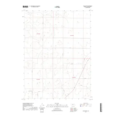
2017 Map of Stapleton SW
USGS Topo · Published 2017About this map
Lincoln County cattle country defines this landscape, characterized by the undulating sand hills of central Nebraska. The sparse network of section-line roads, such as Sand Hill Rd and Clinton Rd, underscores the large-scale ranching operations that have shaped this region for generations. These corridors provide essential access through the terrain, connecting isolated homesteads and grazing lands.
Find a feature on this map
15 named features on this map. Tap any name to fly to it.
Don’t see what you’re looking for? This feature index may not catch every label — zoom into the map to look around manually.
Map Details
Editions of this 2017 Stapleton SW Map
This is the sole edition of this map. No revisions or reprints were ever made.
Other maps of this area

1899 · North Platte
USGS Topo · 1:125,000

1902 · North Platte
USGS Topo · 1:125,000

1954 · North Platte
USGS Topo · 1:250,000

1956 · North Platte
USGS Topo · 1:250,000

1957 · North Platte
USGS Topo · 1:250,000

1967 · North Platte
USGS Topo · 1:250,000

1970 · North Platte East
USGS Topo · 1:24,000

1970 · North Platte West
USGS Topo · 1:24,000
1970 · Maxwell NE
USGS Topo · 1:24,000

1972 · Stapleton NW
USGS Topo · 1:24,000