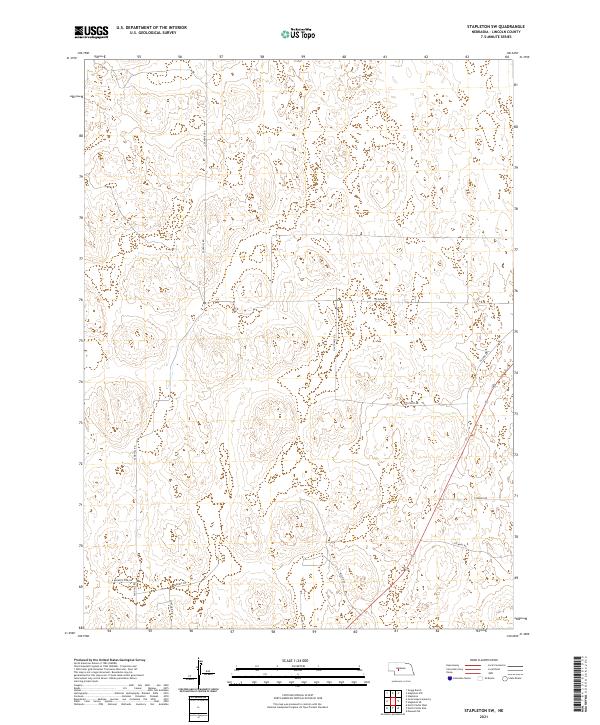
2021 Map of Stapleton SW
USGS Topo · Published 2021About this map
Lincoln County’s characteristic Nebraska Sandhills landscape is defined here by a network of sectional roads and the subtle topography of the high plains. This 2021 survey of the Stapleton SW quadrangle showcases the rural infrastructure connecting scattered ranches and homesteads through corridors like Sandhill Rd and Sand Hill Rd. The map layout reflects the rigid structure of the Public Land Survey System, with boundaries such as t16n r30w and t16n r29w organizing the vast open spaces.
Find a feature on this map
16 named features on this map. Tap any name to fly to it.
Don’t see what you’re looking for? This feature index may not catch every label — zoom into the map to look around manually.
Map Details
Editions of this 2021 Stapleton SW Map
This is the sole edition of this map. No revisions or reprints were ever made.
Other maps of this area

1899 · North Platte
USGS Topo · 1:125,000

1902 · North Platte
USGS Topo · 1:125,000

1954 · North Platte
USGS Topo · 1:250,000

1956 · North Platte
USGS Topo · 1:250,000

1957 · North Platte
USGS Topo · 1:250,000

1967 · North Platte
USGS Topo · 1:250,000

1970 · North Platte East
USGS Topo · 1:24,000

1970 · North Platte West
USGS Topo · 1:24,000
1970 · Maxwell NE
USGS Topo · 1:24,000

1972 · Stapleton NW
USGS Topo · 1:24,000