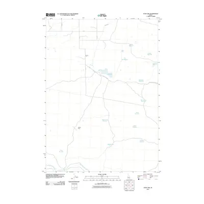
2010 Map of Star Lake
USGS Topo · Published 2010About this map
Star Lake Ranch sits at the heart of this landscape, a testament to the managed water systems that sustain agriculture in Jerome County. The terrain is defined by an extensive network of irrigation and storage, anchored in the south by the Milner Gooding Canal and Lateral 702-A. The map reveals a high concentration of small, named catchments such as Seeding Reservoir, Pintail Reservoir, and East Artifact Reservoir, suggesting a carefully engineered environment for livestock or seasonal agriculture. The naming conventions, including Zero Lake and 26 Mile Lake, indicate a region organized around distance and utility. Significant landmarks like Wilson Butte and the Star Lake Storage Berm Rd provide structural orientation amidst the many pools and lakes that dot this high desert quadrangle.
Find a feature on this map
24 named features on this map. Tap any name to fly to it.
Don’t see what you’re looking for? This feature index may not catch every label — zoom into the map to look around manually.
Map Details
Editions of this 2010 Star Lake Map
This is the sole edition of this map. No revisions or reprints were ever made.
Other maps of this area

1955 · Twin Falls
USGS Topo · 1:250,000

1958 · Twin Falls
USGS Topo · 1:250,000

1964 · Hazelton NE
USGS Topo · 1:24,000

1964 · Perrine
USGS Topo · 1:24,000

1964 · Hunt
USGS Topo · 1:24,000

1971 · Shoshone SE
USGS Topo · 1:24,000

1971 · Star Lake
USGS Topo · 1:24,000

1971 · Owinza
USGS Topo · 1:24,000

1971 · Dietrich
USGS Topo · 1:24,000

1971 · Dietrich Butte
USGS Topo · 1:24,000