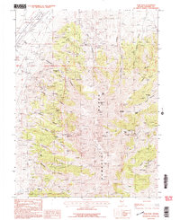
1987 Map of Star Peak
USGS Topo · Published 1987About this map
Humboldt City occupies a significant historical footprint in this portion of the Humboldt Range, surrounded by a dense network of silver and gold extraction sites from the late nineteenth century. The map reveals the intricate mining geography of Pershing County, where the high ridges are punctuated by named peaks like Star Peak and Indian Ikes Point. Industrial activity is evidenced by numerous mine shafts and operations including the Imlay Mine, Starlight Mine, and Queen of Sheba Mine. These sites are linked by a complex system of 4wd tracks that navigate the steep terrain between Florida Canyon and Bloody Canyon. The presence of tailings, a Radio Facility, and a Substation near the Pipeline reflects the modernization of this mineral-rich corridor, while the Cem near the old city site serves as a quiet reminder of the pioneer era's resident populations.
Find a feature on this map
51 named features on this map. Tap any name to fly to it.
Don’t see what you’re looking for? This feature index may not catch every label — zoom into the map to look around manually.
Map Details
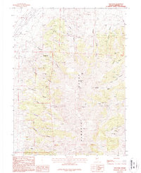
Editions of this 1987 Star Peak Map
2 editions found
Other maps of this area

1931 · Lovelock
USGS Topo · 1:250,000

1935 · Lovelock
USGS Topo · 1:250,000

1954 · Unionville
USGS Topo · 1:62,500

1955 · Lovelock
USGS Topo · 1:250,000

1956 · Oreana
USGS Topo · 1:62,500

1956 · Imlay
USGS Topo · 1:62,500

1959 · Lovelock
USGS Topo · 1:250,000

1971 · Rye Patch Reservoir South
USGS Topo · 1:24,000

1971 · Rye Patch Reservoir North
USGS Topo · 1:24,000

1984 · Lovelock
USGS Topo · 1:100,000