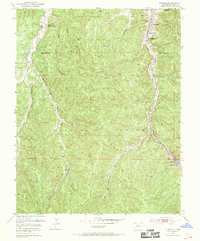
1951 Map of Starkville
USGS Topo · Published 1969About this map
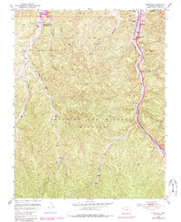
Starkville and Morley appear here as industrial hubs defined by their extraction history and transit corridors. The landscape is dominated by the massive Maxwell Grant Boundary, which bisects the terrain and underscores the region's complex land grant history. Along the eastern edge, the Atchison Topeka and Santa Fe railroad follows the course of Raton Creek, running parallel to U.S. 85-87. This corridor was the lifeblood of the local economy, serving the now Starkville Mines (Inactive) and Morley Mine (Inactive).
Find a feature on this map
28 named features on this map. Tap any name to fly to it.
Don’t see what you’re looking for? This feature index may not catch every label — zoom into the map to look around manually.
Map Details
Editions of this 1951 Starkville Map
5 editions found
Other maps of this area

1891 · Spanish Peaks
USGS Topo · 1:125,000

1892 · Elmoro
USGS Topo · 1:125,000

1893 · Spanish Peaks
USGS Topo · 1:125,000

1893 · Elmoro
USGS Topo · 1:125,000

1895 · Spanish Peaks
USGS Topo · 1:125,000

1897 · Elmoro
USGS Topo · 1:125,000

1897 · Spanish Peaks
USGS Topo · 1:125,000

1900 · Spanish Peaks
USGS Topo · 1:125,000

1912 · Raton
USGS Topo · 1:62,500

1914 · Raton
USGS Topo · 1:62,500