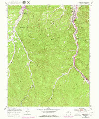
1951 Map of Starkville
USGS Topo · Published 1979About this map
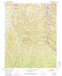
The settlement of Starkville serves as the focal point for this 1951 study, showing a community structured around three distinct educational institutions: North Starkville School, Central Starkville School, and South Starkville School. Industry and infrastructure are heavily emphasized along the Atchison Topeka and Santa Fe railroad corridor, where the Starkville Mines (Inactive) and numerous slack piles stand as quiet evidence of the area's coal mining heritage.
Find a feature on this map
27 named features on this map. Tap any name to fly to it.
Don’t see what you’re looking for? This feature index may not catch every label — zoom into the map to look around manually.
Map Details
Editions of this 1951 Starkville Map
5 editions found
Other maps of this area

1891 · Spanish Peaks
USGS Topo · 1:125,000

1892 · Elmoro
USGS Topo · 1:125,000

1893 · Spanish Peaks
USGS Topo · 1:125,000

1893 · Elmoro
USGS Topo · 1:125,000

1895 · Spanish Peaks
USGS Topo · 1:125,000

1897 · Elmoro
USGS Topo · 1:125,000

1897 · Spanish Peaks
USGS Topo · 1:125,000

1900 · Spanish Peaks
USGS Topo · 1:125,000

1912 · Raton
USGS Topo · 1:62,500

1914 · Raton
USGS Topo · 1:62,500