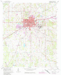
1965 Map of Starkville
USGS Topo · Published 1982About this map
Starkville serves as the focal point of this Mississippi survey, where the expanding urban footprint in the 1960s and early 1980s is captured through residential growth and institutional development. The eastern portion of the sheet is dominated by Mississippi State University, formerly labeled State College, showing the detailed campus layout adjacent to the Illinois Central Gulf rail line. Beyond the city center, the landscape transitions into a network of small creeks with distinctive names such as Tobacco Juice Creek and Talking Warrior Creek. Local life is recorded through numerous rural landmarks, including the Odd Fellows Cem, Henderson High Sch, and several community churches like Spring Hill Ch and New Prospect Ch. The map also documents the regional aviation infrastructure at George M Bryan Airport and the specialized university lands at the Mississippi State University School of Forest Resources.
Find a feature on this map
44 named features on this map. Tap any name to fly to it.
Don’t see what you’re looking for? This feature index may not catch every label — zoom into the map to look around manually.
Map Details
Editions of this 1965 Starkville Map
4 editions found
Other maps of this area

1953 · West Point
USGS Topo · 1:250,000

1958 · West Point
USGS Topo · 1:250,000

1959 · Artesia
USGS Topo · 1:62,500

1959 · West Point
USGS Topo · 1:62,500

1959 · Pheba
USGS Topo · 1:62,500

1963 · West Point
USGS Topo · 1:250,000

1965 · Starkville
USGS Topo · 1:24,000

1965 · Bluff Lake
USGS Topo · 1:24,000

1965 · Longview
USGS Topo · 1:24,000

1965 · Bradley
USGS Topo · 1:24,000