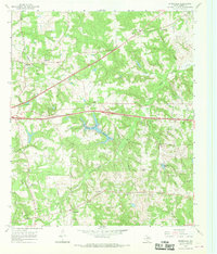
1966 Map of Starrville
USGS Topo · Published 1969About this map
The Chapel Hill Oil Field dominates the southern landscape of this mid-1960s survey, marked by a dense network of refineries, gas wells, and pipelines that reveal the industrial character of Smith County during this era. Further north, the settlement of Starrville serves as a local hub near Midway and the Roadside Park, while smaller communities like Browning and Friendship are anchored by several country churches and family cemeteries.
Find a feature on this map
42 named features on this map. Tap any name to fly to it.
Don’t see what you’re looking for? This feature index may not catch every label — zoom into the map to look around manually.
Map Details
Editions of this 1966 Starrville Map
2 editions found
Other maps of this area

1936 · Kilgore
USGS Topo · 1:48,000

1938 · Winona
USGS Topo · 1:48,000

1940 · Kilgore
USGS Topo · 1:62,500

1943 · Winona
USGS Topo · 1:62,500

1956 · Tyler
USGS Topo · 1:250,000

1960 · Hawkins
USGS Topo · 1:24,000

1960 · Big Sandy
USGS Topo · 1:24,000

1960 · Gladewater
USGS Topo · 1:24,000

1966 · Hope Pond
USGS Topo · 1:24,000
1966 · Bascom
USGS Topo · 1:24,000