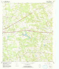
1966 Map of Starrville
USGS Topo · Published 1992About this map
The Chapel Hill Oil Field and Wright Mountain Field dominate this landscape in eastern Smith County, illustrating the mid-century industrial footprint of oil and gas production. Scattered refineries, oil wells, and a network of pipelines crisscross the terrain between established settlements like Starrville and Midway. The presence of a Refinery near Gees Memorial Ch highlights the close proximity of heavy industry to long-standing rural community centers.
Find a feature on this map
46 named features on this map. Tap any name to fly to it.
Don’t see what you’re looking for? This feature index may not catch every label — zoom into the map to look around manually.
Map Details
Editions of this 1966 Starrville Map
2 editions found
Other maps of this area

1936 · Kilgore
USGS Topo · 1:48,000

1938 · Winona
USGS Topo · 1:48,000

1940 · Kilgore
USGS Topo · 1:62,500

1943 · Winona
USGS Topo · 1:62,500

1956 · Tyler
USGS Topo · 1:250,000

1960 · Hawkins
USGS Topo · 1:24,000

1960 · Big Sandy
USGS Topo · 1:24,000

1960 · Gladewater
USGS Topo · 1:24,000

1966 · Hope Pond
USGS Topo · 1:24,000
1966 · Starrville
USGS Topo · 1:24,000