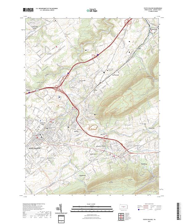
2023 Map of State College
USGS Topo · Published 2023About this map
State College and University Park serve as the central hubs of this landscape, where the academic campus meets the residential expansion of the Nittany Valley. The terrain is defined by the massive presence of Nittany Mountain to the east and Tussey Mountain to the south, creating a corridor of settlement that follows the paths of Spring Creek and Slab Cabin Run. This modern survey reveals how the growth of suburbs like Panorama Village, Harris Acres, and Dale Summit has filled the spaces between the historic cores of Boalsburg and Lemont.
Find a feature on this map
223 named features on this map. Tap any name to fly to it.
Don’t see what you’re looking for? This feature index may not catch every label — zoom into the map to look around manually.
Map Details
Editions of this 2023 State College Map
This is the sole edition of this map. No revisions or reprints were ever made.
Other maps of this area

1908 · Bellefonte
USGS Topo · 1:62,500

1909 · Bellefonte
USGS Topo · 1:62,500

1919 · Menno
USGS Topo · 1:62,500

1924 · Centre Hall
USGS Topo · 1:62,500

1924 · Lewistown
USGS Topo · 1:62,500

1927 · Lewisburg
USGS Topo · 1:62,500

1929 · Centre Hall
USGS Topo · 1:62,500

1935 · Allensville
USGS Topo · 1:62,500

1938 · Allensville
USGS Topo · 1:62,500

1943 · Lewistown
USGS Topo · 1:125,000