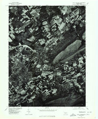
1977 Map of State College
USGS Topo · Published 1979About this map
State College and its surrounding valley floor are captured in this orthophotograph, providing a bird's-eye view of the central Pennsylvania landscape in the late 1970s. The prominent rising terrain of Mount Nittany anchors the eastern edge of the survey, contrasting with the dense development and grid patterns of the borough and the nearby settlements of Lemont and Houserville. The course of Spring Creek winds through the northern portion of the map, carving through agricultural fields that show the distinct strip-cropping patterns common to the region's farming heritage. This imagery provides a clear look at the area's infrastructure before decades of later expansion, showing the proximity of quiet wooded ridges to the growing academic and residential hub of the county.
Find a feature on this map
6 named features on this map. Tap any name to fly to it.
Don’t see what you’re looking for? This feature index may not catch every label — zoom into the map to look around manually.
Map Details
Editions of this 1977 State College Map
This is the sole edition of this map. No revisions or reprints were ever made.
Other maps of this area

1908 · Bellefonte
USGS Topo · 1:62,500

1909 · Bellefonte
USGS Topo · 1:62,500

1919 · Menno
USGS Topo · 1:62,500

1924 · Centre Hall
USGS Topo · 1:62,500

1924 · Lewistown
USGS Topo · 1:62,500

1927 · Lewisburg
USGS Topo · 1:62,500

1929 · Centre Hall
USGS Topo · 1:62,500

1935 · Allensville
USGS Topo · 1:62,500

1938 · Allensville
USGS Topo · 1:62,500

1943 · Lewistown
USGS Topo · 1:125,000