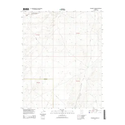
2014 Map of Steamboat Canyon
USGS Topo · Published 2014About this map
Steamboat Canyon cuts through the high desert of the Navajo Nation, providing a dramatic landscape defined by its network of Bureau of Indian Affairs and county roads. In this 2014 survey, the boundary between Apache County and Navajo County bisects the terrain, illustrating the jurisdictional lines that cross this expansive territory. The map highlights sparse but vital water sources like Joseph Spring, which remains a critical landmark in an otherwise arid environment. This topographical study focuses on the intricate drainage patterns and the complex roadway system, including Az-264 and various regional connectors such as Co Road C316 and Bia-9055, which link the remote canyons and plateaus of the Fort Defiance Agency.
Find a feature on this map
14 named features on this map. Tap any name to fly to it.
Don’t see what you’re looking for? This feature index may not catch every label — zoom into the map to look around manually.
Map Details
Editions of this 2014 Steamboat Canyon Map
This is the sole edition of this map. No revisions or reprints were ever made.
Other maps of this area

1886 · Fort Defiance
USGS Topo · 1:250,000

1892 · Fort Defiance
USGS Topo · 1:250,000

1954 · Gallup
USGS Topo · 1:250,000

1958 · Gallup
USGS Topo · 1:250,000

1959 · Gallup
USGS Topo · 1:250,000

1962 · Gallup
USGS Topo · 1:250,000

1967 · Gallup
USGS Topo · 1:250,000
1972 · Steamboat Canyon
USGS Topo · 1:24,000
1972 · Toyei School
USGS Topo · 1:24,000
1972 · Greasewood
USGS Topo · 1:24,000