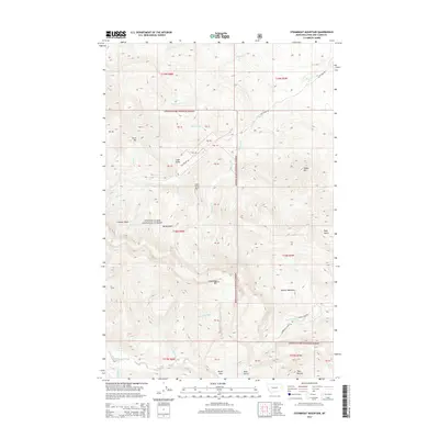
2014 Map of Steamboat Mountain
USGS Topo · Published 2014About this map
Steamboat Mtn and Lone Chief Mtn dominate this high-altitude section of the Lewis & Clark National Forest in Montana. The landscape is defined by its dramatic drainage networks, with the Dearborn River flowing through the southern portion near Devils Glen. Notable water features include Cataract Falls and various creeks such as Blubber Cr, Cyanide Cr, and Clemons Cr.
Find a feature on this map
37 named features on this map. Tap any name to fly to it.
Don’t see what you’re looking for? This feature index may not catch every label — zoom into the map to look around manually.
Map Details
Editions of this 2014 Steamboat Mountain Map
This is the sole edition of this map. No revisions or reprints were ever made.
Other maps of this area

1903 · Coopers Lake
USGS Topo · 1:125,000

1943 · Hogan
USGS Topo · 1:125,000

1955 · Choteau
USGS Topo · 1:250,000

1957 · Choteau
USGS Topo · 1:250,000

1958 · Choteau
USGS Topo · 1:250,000

1962 · Choteau
USGS Topo · 1:250,000
1963 · Blowout Mountain
USGS Topo · 1:24,000
1963 · Augusta
USGS Topo · 1:24,000
1963 · Bean Lake
USGS Topo · 1:24,000

1968 · Heart Lake
USGS Topo · 1:24,000