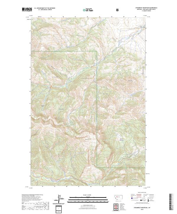
2024 Map of Steamboat Mountain
USGS Topo · Published 2024About this map
Steamboat Mtn and Lone Chief Mtn anchor this high-elevation landscape in the Lewis & Clark National Forest, where the Dearborn River carves a path through the southern reaches. The drainage network is complex, featuring water bodies like Cyanide Creek, Elk Creek, and Cataract Creek, which feeds into the named Cataract Falls. Toward the southwest, the terrain transitions into the protected Scapegoat Wilderness, marked by distinctive features such as Devils Glen and Cataract Basin. The map illustrates a network of early 21st-century access routes including the Elk Creek Rd and the Dearborn Canyon Rd, alongside dedicated footpaths like the Sawmill Creek Trl and the Dearborn River Trl. This area, defined by ridges like Harrison Basin Ridge and isolated peaks like Twin Buttes, remains largely defined by its natural topography and wilderness status rather than permanent human settlements.
Find a feature on this map
53 named features on this map. Tap any name to fly to it.
Don’t see what you’re looking for? This feature index may not catch every label — zoom into the map to look around manually.
Map Details
Editions of this 2024 Steamboat Mountain Map
This is the sole edition of this map. No revisions or reprints were ever made.
Other maps of this area

1903 · Coopers Lake
USGS Topo · 1:125,000

1943 · Hogan
USGS Topo · 1:125,000

1955 · Choteau
USGS Topo · 1:250,000

1957 · Choteau
USGS Topo · 1:250,000

1958 · Choteau
USGS Topo · 1:250,000

1962 · Choteau
USGS Topo · 1:250,000
1963 · Blowout Mountain
USGS Topo · 1:24,000
1963 · Augusta
USGS Topo · 1:24,000
1963 · Bean Lake
USGS Topo · 1:24,000

1968 · Heart Lake
USGS Topo · 1:24,000