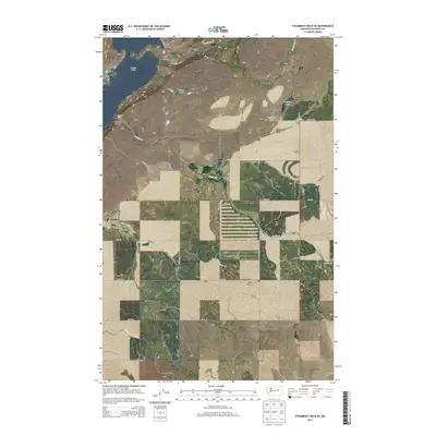
2014 Map of Steamboat Rock SE
USGS Topo · Published 2014About this map
Gibraltar Rock and the high walls of Northrup Canyon dominate the northern landscape of this region, where the plateau transition meets the eastern shores of Banks Lake. The map reveals a high-desert environment deeply etched by coulees and seasonal drainages, including Whitney Canyon and the expansive Paynes Gulch to the south.
Find a feature on this map
36 named features on this map. Tap any name to fly to it.
Don’t see what you’re looking for? This feature index may not catch every label — zoom into the map to look around manually.
Map Details
Editions of this 2014 Steamboat Rock SE Map
This is the sole edition of this map. No revisions or reprints were ever made.
Other maps of this area

1948 · Grand Coulee Dam
USGS Topo · 1:62,500

1950 · Grand Coulee Dam
USGS Topo · 1:62,500

1953 · Ritzville
USGS Topo · 1:250,000

1959 · Ritzville
USGS Topo · 1:250,000

1965 · Ritzville
USGS Topo · 1:250,000

1968 · Steamboat Rock SW
USGS Topo · 1:24,000

1968 · Barker Canyon
USGS Topo · 1:24,000

1968 · Hartline
USGS Topo · 1:24,000

1968 · Steamboat Rock SE
USGS Topo · 1:24,000
1968 · Hartline NW
USGS Topo · 1:24,000