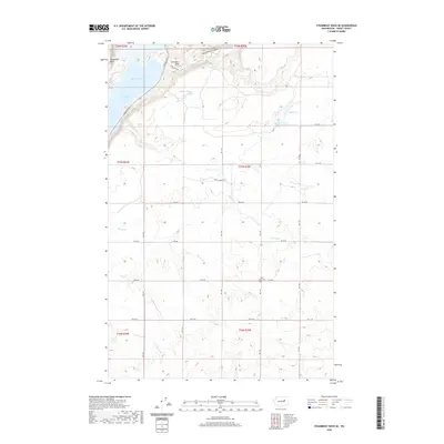
2020 Map of Steamboat Rock SE
USGS Topo · Published 2020About this map
Steamboat Rock and the towering Gibraltar Rock dominate the northern landscape of this Grant County corridor, flanking the waters of Banks Lake. The terrain is defined by dramatic coulees and canyons, where the Devils Punch Bowl and the steep walls of Northrup Canyon indicate a complex geological history. South of the main lake, a network of smaller water bodies including Willow Lake, Coffee Lake, and the Henning Lakes dot the interior, fed by seasonal drainages like Devils Cr and Rusho Cr.
Find a feature on this map
29 named features on this map. Tap any name to fly to it.
Don’t see what you’re looking for? This feature index may not catch every label — zoom into the map to look around manually.
Map Details
Editions of this 2020 Steamboat Rock SE Map
This is the sole edition of this map. No revisions or reprints were ever made.
Other maps of this area

1948 · Grand Coulee Dam
USGS Topo · 1:62,500

1950 · Grand Coulee Dam
USGS Topo · 1:62,500

1953 · Ritzville
USGS Topo · 1:250,000

1959 · Ritzville
USGS Topo · 1:250,000

1965 · Ritzville
USGS Topo · 1:250,000

1968 · Steamboat Rock SW
USGS Topo · 1:24,000

1968 · Barker Canyon
USGS Topo · 1:24,000

1968 · Hartline
USGS Topo · 1:24,000

1968 · Steamboat Rock SE
USGS Topo · 1:24,000
1968 · Hartline NW
USGS Topo · 1:24,000