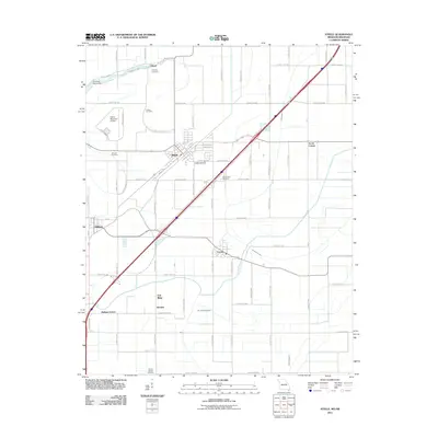
2011 Map of Steele
USGS Topo · Published 2011About this map
Steele serves as the central hub of this agricultural landscape in the Missouri Bootheel, surrounded by a network of smaller communities including Holland, Cooter, and Gibson. The terrain is defined by an extensive system of water management features, such as the Old Franklin Ditch, Ditch Number 3, and Ditch Number 5, which are essential for draining the low-lying lands near Pemiscot Bayou. This map reveals a high density of small family or community burial grounds, including Hopkins Cemetery, Frakes Cemetery, and Mount Moriah Cemetery, offering significant value for genealogical research in Pemiscot County. The presence of the Steele Municipal Airport and localized points like Acorn Corner and Holbert Corner illustrate the distribution of regional infrastructure and commerce across the rural Missouri-Arkansas border region during the early 21st century.
Find a feature on this map
79 named features on this map. Tap any name to fly to it.
Don’t see what you’re looking for? This feature index may not catch every label — zoom into the map to look around manually.
Map Details
Editions of this 2011 Steele Map
This is the sole edition of this map. No revisions or reprints were ever made.
Other maps of this area

1939 · Hales Point
USGS Topo · 1:62,500

1939 · Caruthersville
USGS Topo · 1:62,500

1939 · Blytheville
USGS Topo · 1:62,500

1940 · Hayti
USGS Topo · 1:62,500

1951 · Caruthersville
USGS Topo · 1:62,500

1952 · Hales Point
USGS Topo · 1:62,500

1955 · Hayti
USGS Topo · 1:62,500

1955 · Blytheville
USGS Topo · 1:62,500

1956 · Dyersburg
USGS Topo · 1:250,000

1956 · Blytheville
USGS Topo · 1:250,000