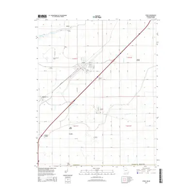
2015 Map of Steele
USGS Topo · Published 2015About this map
Steele serves as the central hub of this Missouri-Arkansas border region, where an intricate network of drainage systems like Ditch Number 3, Ditch Number 5, and the Old Franklin Ditch has reshaped the low-lying terrain of Pemiscot County. The landscape is dotted with family and community landmarks, including Hopkins Cemetery, Frakes Cemetery, and Mount Zion Cemetery, which offer valuable coordinates for genealogical research. Smaller settlements such as Gibson, Cooter, and Holland anchor the surrounding agricultural blocks, while Holbert Corner and Acorn Corner mark specific rural junctions. Near the western edge, Pemiscot Bayou Lake and the meandering Pemiscot Bayou provide a natural contrast to the rigid grid of county roads. The presence of the Steele Municipal Airport and multiple cemetery sites like Barnard Cemetery and Number 8 Cemetery underscores a settled, lived-in landscape defined by both its transport infrastructure and its long-standing local history.
Find a feature on this map
75 named features on this map. Tap any name to fly to it.
Don’t see what you’re looking for? This feature index may not catch every label — zoom into the map to look around manually.
Map Details
Editions of this 2015 Steele Map
This is the sole edition of this map. No revisions or reprints were ever made.
Other maps of this area

1939 · Hales Point
USGS Topo · 1:62,500

1939 · Caruthersville
USGS Topo · 1:62,500

1939 · Blytheville
USGS Topo · 1:62,500

1940 · Hayti
USGS Topo · 1:62,500

1951 · Caruthersville
USGS Topo · 1:62,500

1952 · Hales Point
USGS Topo · 1:62,500

1955 · Hayti
USGS Topo · 1:62,500

1955 · Blytheville
USGS Topo · 1:62,500

1956 · Dyersburg
USGS Topo · 1:250,000

1956 · Blytheville
USGS Topo · 1:250,000