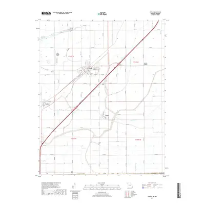
2017 Map of Steele
USGS Topo · Published 2017About this map
Steele and its surrounding agricultural landscape dominate this southern corner of Pemiscot County. The town is situated along a major transportation corridor, with Interstate 55 and U.S. Highway 61 cutting diagonally through the center of the sheet, providing a modern contrast to the deep-seated rural character of the region. Local genealogy is well-served by several rural burial grounds, including Hopkins Cem near Gibson and Mount Zion Cem further south.
Find a feature on this map
98 named features on this map. Tap any name to fly to it.
Don’t see what you’re looking for? This feature index may not catch every label — zoom into the map to look around manually.
Map Details
Editions of this 2017 Steele Map
This is the sole edition of this map. No revisions or reprints were ever made.
Other maps of this area

1939 · Hales Point
USGS Topo · 1:62,500

1939 · Caruthersville
USGS Topo · 1:62,500

1939 · Blytheville
USGS Topo · 1:62,500

1940 · Hayti
USGS Topo · 1:62,500

1951 · Caruthersville
USGS Topo · 1:62,500

1952 · Hales Point
USGS Topo · 1:62,500

1955 · Hayti
USGS Topo · 1:62,500

1955 · Blytheville
USGS Topo · 1:62,500

1956 · Dyersburg
USGS Topo · 1:250,000

1956 · Blytheville
USGS Topo · 1:250,000