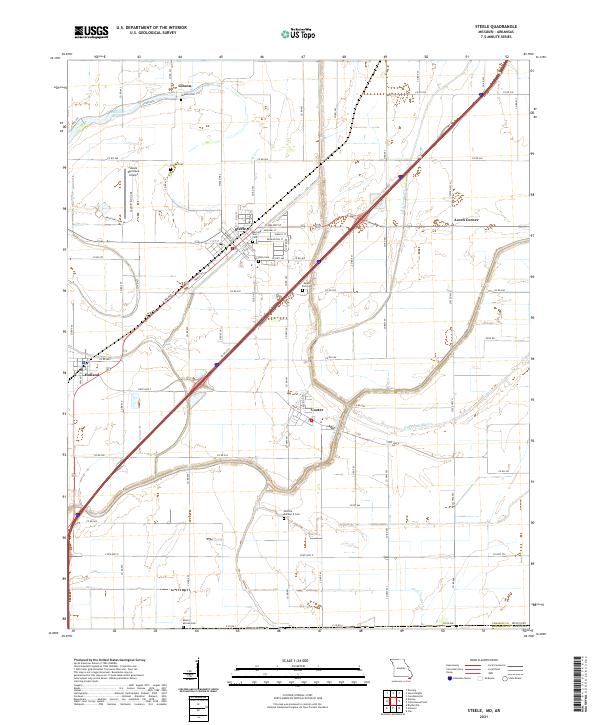
2021 Map of Steele
USGS Topo · Published 2021About this map
Agricultural lands and a complex network of drainage ditches characterize this corner of the Missouri Bootheel, centered on the city of Steele. The landscape is defined by its engineering, with waterways like Ditch Number 3, Ditch Number 5, and the Old Franklin Ditch following the geometric grid of the surrounding cotton and soybean fields. This 2021 survey reveals a high density of rural burial sites, providing vital data for genealogists tracing families in Pemiscot County.
Find a feature on this map
94 named features on this map. Tap any name to fly to it.
Don’t see what you’re looking for? This feature index may not catch every label — zoom into the map to look around manually.
Map Details
Editions of this 2021 Steele Map
This is the sole edition of this map. No revisions or reprints were ever made.
Other maps of this area

1939 · Hales Point
USGS Topo · 1:62,500

1939 · Caruthersville
USGS Topo · 1:62,500

1939 · Blytheville
USGS Topo · 1:62,500

1940 · Hayti
USGS Topo · 1:62,500

1951 · Caruthersville
USGS Topo · 1:62,500

1952 · Hales Point
USGS Topo · 1:62,500

1955 · Hayti
USGS Topo · 1:62,500

1955 · Blytheville
USGS Topo · 1:62,500

1956 · Dyersburg
USGS Topo · 1:250,000

1956 · Blytheville
USGS Topo · 1:250,000