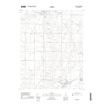
2018 Map of Steeleville
USGS Topo · Published 2018About this map
Sparta and Steeleville serve as the primary anchors for this Randolph County landscape, where the agricultural grid is deeply intertwined with the drainage systems of the Marys River and Little Marys River. The town of Sparta is centered around a well-defined street plan including W Broadway St and W Main St, sitting just north of the Old City Reservoir. Smaller communities like Eden, Blair, and Percy dot the outlying areas, often associated with local landmarks such as Caledonia Cem or the Independent Order of Odd Fellows Cem. The topography reveals a transition from the structured street blocks of the incorporated towns to the winding rural routes like Bockhorn Rd and Holloway Rd, which navigate the creek valleys of Maxwell Cr and Lick Br.
Find a feature on this map
91 named features on this map. Tap any name to fly to it.
Don’t see what you’re looking for? This feature index may not catch every label — zoom into the map to look around manually.
Map Details
Editions of this 2018 Steeleville Map
This is the sole edition of this map. No revisions or reprints were ever made.
Other maps of this area

1912 · Baldwin
USGS Topo · 1:62,500

1914 · Baldwin
USGS Topo · 1:62,500

1914 · Coulterville
USGS Topo · 1:62,500

1915 · Chester
USGS Topo · 1:62,500

1916 · Campbell Hill
USGS Topo · 1:62,500

1917 · Coulterville
USGS Topo · 1:62,500

1918 · Campbell Hill
USGS Topo · 1:62,500

1942 · Baldwin
USGS Topo · 1:62,500

1947 · Chester
USGS Topo · 1:62,500

1949 · Paducah
USGS Topo · 1:250,000