2024 Map of Steeleville
USGS Topo · Published 2024About this map
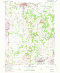
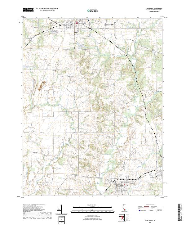
Marys River and its western counterpart, the Little Marys River, create a deeply dissected landscape across this portion of Randolph County. The drainage network defines the movement of early travel and modern roads, with several small agricultural and transit hubs established on the higher ground between these waterways. Steeleville and Percy anchor the southern reach, while Sparta occupies the northern edge near the Old City Reservoir. The map provides specific detail for local researchers, identifying the Peace Lutheran Cem and Percy Village Cem, alongside transit corridors like the Shawneetwon Trl. This area reflects a long-standing settlement pattern where small communities like Eden and Blair are linked by a network of rural routes such as Schuline Rd and Holloway Rd.
Find a feature on this map
79 named features on this map. Tap any name to fly to it.
Don’t see what you’re looking for? This feature index may not catch every label — zoom into the map to look around manually.
Map Details
Editions of this 2024 Steeleville Map
This is the sole edition of this map. No revisions or reprints were ever made.