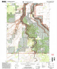
1992 Map of Steelhead Falls
USGS Topo · Published 1997About this map
The dramatic confluence of the Deschutes River and the Crooked River shapes this high desert landscape, dominated by the deeply incised Crooked River Gorge and the waters of Lake Billy Chinook. Much of the territory falls within the Crooked River National Grassland, where the plateau known as The Peninsula rises sharply above the water. Historical human activity is concentrated in the northern reaches near the settlement of Grandview, which includes the Grandview Cemetery, and further south at Holmes Ranch. The map details the early 1990s infrastructure that manages these river systems, including a powerplant, gaging station, diversion dam, and an aqueduct near Opal Springs. From the sheer walls of Squaw Mouth to the descent at Steelhead Falls, the topography reflects a land defined by volcanic geology and the intensive management of its scarce water resources.
Find a feature on this map
30 named features on this map. Tap any name to fly to it.
Don’t see what you’re looking for? This feature index may not catch every label — zoom into the map to look around manually.
Map Details
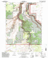
Editions of this 1992 Steelhead Falls Map
2 editions found
Other maps of this area

1926 · Bend
USGS Topo · 1:125,000

1928 · Madras
USGS Topo · 1:125,000

1929 · Bend
USGS Topo · 1:125,000

1931 · Madras
USGS Topo · 1:125,000

1955 · Bend
USGS Topo · 1:250,000

1957 · Bend
USGS Topo · 1:250,000

1958 · Bend
USGS Topo · 1:250,000

1961 · Redmond
USGS Topo · 1:24,000

1962 · Opal City
USGS Topo · 1:24,000

1962 · Fly Creek
USGS Topo · 1:24,000