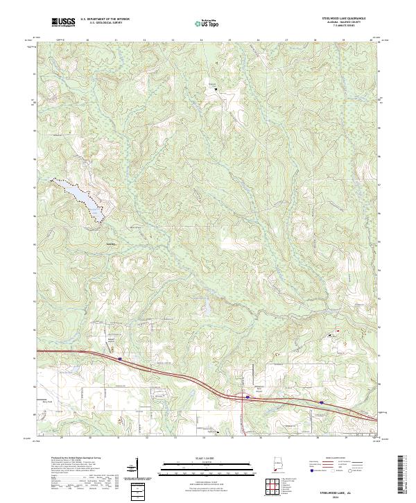
2024 Map of Steelwood Lake
USGS Topo · Published 2024About this map
The Styx River meanders through this portion of Baldwin County, defining a landscape of low-lying wetlands and established rural infrastructure. The map centers on the community of Loxley and the elevated terrain of Steelwood Ridge, where the residential and recreational waters of Steelwood Lake are situated. This area reflects a long-standing agricultural and transport pattern, with older cemeteries like Magnolia Cem and Hinote Cem marking early settlement nodes.
Find a feature on this map
74 named features on this map. Tap any name to fly to it.
Don’t see what you’re looking for? This feature index may not catch every label — zoom into the map to look around manually.
Map Details
Editions of this 2024 Steelwood Lake Map
This is the sole edition of this map. No revisions or reprints were ever made.
Other maps of this area

1920 · Robertsdale
USGS Topo · 1:62,500

1921 · Fairhope
USGS Topo · 1:62,500

1940 · Silverhill
USGS Topo · 1:31,680

1941 · Silverhill
USGS Topo · 1:31,680

1941 · Bay Minette
USGS Topo · 1:62,500

1941 · Robertsdale
USGS Topo · 1:62,500

1941 · Fairhope
USGS Topo · 1:62,500
1942 · Silverhill
USGS Topo · 1:31,680

1942 · Dyas
USGS Topo · 1:62,500

1943 · Robertsdale
USGS Topo · 1:62,500