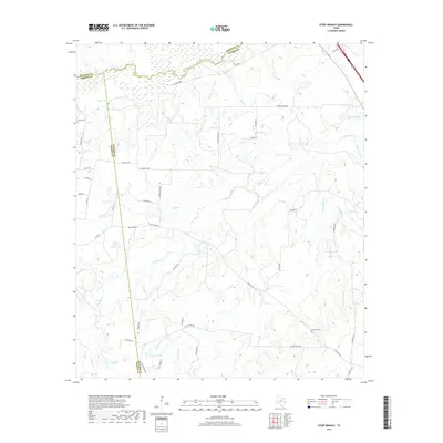
2019 Map of Steep Branch
USGS Topo · Published 2019About this map
The convergence of Madison, Grimes, and Walker counties defines this landscape of creeks and small private lakes. Deeply etched by drainage ways like Bedias Creek and its southern namesake, South Bedias Creek, the area shows a transition from the marshy wetlands in the north to the more defined ranching and residential land in the south. Genealogists and local historians will find several well-preserved family and community landmarks, including Carter Cemetery, Long Cemetery, and McAdams Cemetery, which sit among winding routes like J C Walker Loop and Round Prairie Road. The proliferation of man-made bodies of water, such as Murff Lake, Romano Lake, and Ubanoski Lake, suggests a 21st-century landscape heavily influenced by private land management and agricultural water needs in this corner of East Texas.
Find a feature on this map
49 named features on this map. Tap any name to fly to it.
Don’t see what you’re looking for? This feature index may not catch every label — zoom into the map to look around manually.
Map Details
Editions of this 2019 Steep Branch Map
This is the sole edition of this map. No revisions or reprints were ever made.
Other maps of this area

1954 · Beaumont
USGS Topo · 1:250,000

1957 · Beaumont
USGS Topo · 1:250,000

1961 · Singleton
USGS Topo · 1:24,000

1962 · Connor
USGS Topo · 1:24,000

1962 · Galilee
USGS Topo · 1:24,000

1962 · Baker Lake
USGS Topo · 1:24,000

1963 · Bedias
USGS Topo · 1:24,000

1963 · Steep Branch
USGS Topo · 1:24,000

1963 · Crabbs Prairie
USGS Topo · 1:24,000

1963 · Madisonville
USGS Topo · 1:24,000