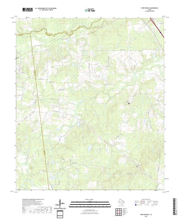
2022 Map of Steep Branch
USGS Topo · Published 2022About this map
The convergence of Madison, Grimes, and Walker counties defines this rural Texas landscape, where the meandering course of Bedias Cr and its complex network of tributaries like Steep Br and Schoolhouse Br dictate the local geography. The area is characterized by a sparse, winding road system including the J C Walker Loop and Scales Ranch Rd, reflecting a region dominated by ranching and timber. Several small family and community burial grounds, such as Carter Cem, Paul Chapel Cem, and McAdams Cem, are scattered across the terrain, serving as vital landmarks for genealogical research and local history. Numerous man-made water bodies including Murff Lake and Romano Lake punctuate the landscape, indicating the importance of water management in this multi-county borderland.
Find a feature on this map
52 named features on this map. Tap any name to fly to it.
Don’t see what you’re looking for? This feature index may not catch every label — zoom into the map to look around manually.
Map Details
Editions of this 2022 Steep Branch Map
This is the sole edition of this map. No revisions or reprints were ever made.
Other maps of this area

1954 · Beaumont
USGS Topo · 1:250,000

1957 · Beaumont
USGS Topo · 1:250,000

1961 · Singleton
USGS Topo · 1:24,000

1962 · Connor
USGS Topo · 1:24,000

1962 · Galilee
USGS Topo · 1:24,000

1962 · Baker Lake
USGS Topo · 1:24,000

1963 · Bedias
USGS Topo · 1:24,000

1963 · Steep Branch
USGS Topo · 1:24,000

1963 · Crabbs Prairie
USGS Topo · 1:24,000

1963 · Madisonville
USGS Topo · 1:24,000