
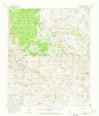
1959 Map of Steeple Rock
USGS Topo · Published 1960About this map
The Summit Mountains and the jagged monolith of Steeple Rock dominate this arid landscape along the border of Grant and Hidalgo counties during the late 1950s. The map reveals a region defined by an extensive mining history, centered around the Carlisle Mine and clusters of claims such as the Billali Mine and Norman King Mine. These industrial sites are interspersed with remote livestock operations, including the Thygerson Ranch, Cottonwood Ranch, and the Bates Ranch.
Find a feature on this map
154 named features on this map. Tap any name to fly to it.
Don’t see what you’re looking for? This feature index may not catch every label — zoom into the map to look around manually.
Map Details
Editions of this 1959 Steeple Rock Map
2 editions found
Other maps of this area

1910 · Mogollon
USGS Topo · 1:125,000

1912 · Mogollon
USGS Topo · 1:125,000

1913 · Morenci
USGS Topo · 1:125,000

1915 · Morenci
USGS Topo · 1:125,000

1954 · Silver City
USGS Topo · 1:250,000

1954 · Clifton
USGS Topo · 1:250,000

1957 · Clifton
USGS Topo · 1:250,000

1958 · Silver City
USGS Topo · 1:250,000

1958 · Clifton
USGS Topo · 1:250,000

1959 · Redrock
USGS Topo · 1:62,500