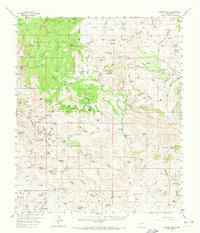
1959 Map of Steeple Rock
USGS Topo · Published 1972About this map
Hard-rock mining operations dominate the western edge of this 1950s survey, particularly in the vicinity of Vanderbilt Peak. Historically significant sites like the Carlisle Mine, Ontario Mine, and Laura Mine reveal the intensive mineral extraction efforts that once centered around Steeple Rock. The rugged landscape is punctuated by numerous family-named landmarks and cattle operations, including the Cottonwood Ranch, Thygerson Ranch, and Estes Ranch.
Find a feature on this map
167 named features on this map. Tap any name to fly to it.
Don’t see what you’re looking for? This feature index may not catch every label — zoom into the map to look around manually.
Map Details
Editions of this 1959 Steeple Rock Map
2 editions found
Other maps of this area

1910 · Mogollon
USGS Topo · 1:125,000

1912 · Mogollon
USGS Topo · 1:125,000

1913 · Morenci
USGS Topo · 1:125,000

1915 · Morenci
USGS Topo · 1:125,000

1954 · Silver City
USGS Topo · 1:250,000

1954 · Clifton
USGS Topo · 1:250,000

1957 · Clifton
USGS Topo · 1:250,000

1958 · Silver City
USGS Topo · 1:250,000

1958 · Clifton
USGS Topo · 1:250,000

1959 · Steeple Rock
USGS Topo · 1:62,500