
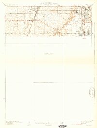
1930 Map of Steger
USGS Topo · Published 1930About this map
The rail-driven expansion of south Cook and Will counties is evident in this late 1920s survey, where several major lines converge to shape the growth of burgeoning commuter and industrial hubs. The Illinois Central and Chicago and Eastern Illinois railroads bisect the landscape, anchoring towns like Matteson, Richton Park, and Steger. An interesting transition is visible in the local transit network, featuring the Chicago and Interurban Electric line alongside established routes like the Sauk Trail and the Old Lincoln Hy.
Find a feature on this map
20 named features on this map. Tap any name to fly to it.
Don’t see what you’re looking for? This feature index may not catch every label — zoom into the map to look around manually.
Map Details
Editions of this 1930 Steger Map
2 editions found
Other maps of this area

1890 · Des Plaines
USGS Topo · 1:62,500

1892 · Calumet
USGS Topo · 1:62,500

1893 · Calumet
USGS Topo · 1:62,500

1894 · Des Plaines
USGS Topo · 1:62,500

1900 · Des Plaines
USGS Topo · 1:62,500

1900 · Calumet
USGS Topo · 1:62,500

1901 · Calumet
USGS Topo · 1:62,500

1901 · Des Plaines
USGS Topo · 1:62,500

1929 · Tinley Park
USGS Topo · 1:24,000

1929 · Calumet City
USGS Topo · 1:24,000