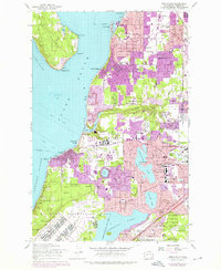
1959 Map of Steilacoom
USGS Topo · Published 1976About this map
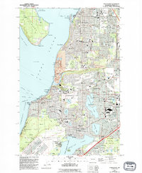
Steilacoom and the southern reaches of Tacoma are defined by a complex interface of suburban growth, institutional land use, and major military installations during the mid-20th century. The prominent campus of the Western Washington State Hospital sits near Chambers Bay, surrounded by evolving residential tracts like Lakewood Center and University Place. Large swaths of the landscape are dedicated to the Fort Lewis Military Reservation and McChord Air Force Base, showing the significant defense footprint in Pierce County.
Find a feature on this map
97 named features on this map. Tap any name to fly to it.
Don’t see what you’re looking for? This feature index may not catch every label — zoom into the map to look around manually.
Map Details
Editions of this 1959 Steilacoom Map
5 editions found
Other maps of this area

1897 · Tacoma
USGS Topo · 1:125,000

1900 · Tacoma
USGS Topo · 1:125,000

1940 · Anderson Island
USGS Topo · 1:62,500

1941 · Tacoma South
USGS Topo · 1:62,500

1942 · Gig Harbor
USGS Topo · 1:62,500

1943 · Gig Harbor
USGS Topo · 1:62,500

1944 · Tacoma South
USGS Topo · 1:62,500

1948 · Anderson Island
USGS Topo · 1:62,500

1948 · Fort Lewis
USGS Topo · 1:24,000

1948 · Nisqually
USGS Topo · 1:24,000